SAR & Infrared Image Annotation
for Tactical & Remote Sensing AI
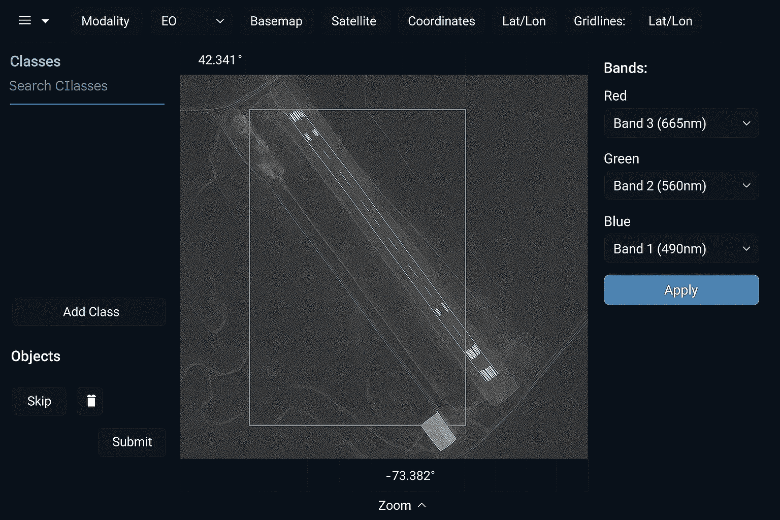
JTheta.ai offers a specialized toolset for annotating SAR (Synthetic Aperture Radar) and
infrared imagery, designed for environments where traditional RGB image tools fall short. Built for remote sensing, defense intelligence, surveillance, and disaster response, our platform helps analysts extract meaningful data from low-visibility, night-time, or atmospheric-affected scenarios using radar and thermal sensors.
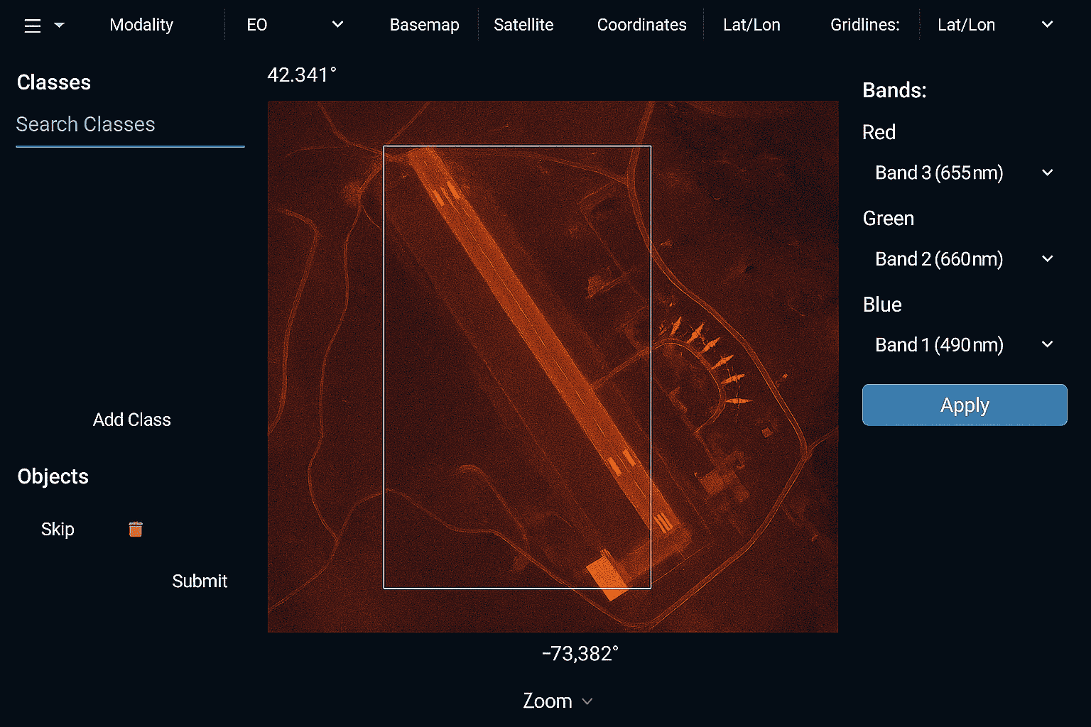
SAR & IR Visualization Enhancements
● Optimized rendering of grayscale, thermal, and radar intensity values
● Layer comparison and dynamic contrast tuning
● Zoom-in for fine segmentation and object classification
Precision Annotation Tools
● Bounding boxes, polygons, and brush tools for fuzzy or indistinct shapes
● Mask overlays to enhance visibility of segmented areas
● AI-powered assistance to detect patterns in noisy datasets
Multimodal Image Handling
● Compare SAR/IR with RGB or multispectral images side-by-side
● Overlay different modalities for deeper analysis
Export Formats for Defense & Research Use
● Export labeled data in GeoTIFF, COCO, JSON
● Compatible with remote sensing pipelines and military-grade model ingestion formats
Secure Workflow for Government Projects
● Role-based access control
● Encrypted project management
● Custom deployment available for secure cloud environments
Use Cases for SAR & Infrared Annotation
Target identification and tracking in defense missions

Night-time object detection using thermal imagery

Post-disaster damage assessment using SAR

Flood zone mapping and terrain analysis

Drone surveillance in extreme environments

Multimodal AI for situational awareness, threat detection

Who Should Use This Tool?
Why JTheta.ai for SAR & IR Annotation?
Traditional annotation platforms aren’t built for non-RGB datasets. JTheta.ai fills that gap by offering support for mission-critical SAR and thermal workflows used in national security, humanitarian response, and advanced AI detection systems.
- Render, annotate, and export SAR/IR images with ease
- Accelerate detection in low-visibility environments
- Built for agencies working with high-sensitivity data
FAQs
→ GeoTIFF, TIFF, PNG, and JPEG (grayscale/thermal) formats are supported.
→ Yes. Our multimodal viewer allows side-by-side and overlay viewing.
→ Yes. We are building with HIPAA/GDPR foundations and offer custom secure deployments.